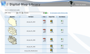
The di Digital Map Library contains detailed digital maps of nearly all UN member states down to the second sub-national level as well as feature layers (e.g., roads, rivers, schools, villages, health facilities, etc.) for selected countries. The maps are downloadable as either .PDF files or shape files and can also be saved as .JPEG files by right-clicking on the map image. All maps are accompanied by downloadable MS-Excel spreadsheets listing the area IDs and area names.
Maps may be imported for use in DevInfo databases (as per attached Technical Note), or other appropriate mapping package.”
Access to the di Digital Map Library is free of cost to all registered users who agree not to use the maps for commercial purposes. To apply to become a registered user, please send a request to support@devinfo.info with the following details.
. Your name
. Your contact details
. Your organization and job title
. Your intended use of the maps |
 |
Please also attach a scanned copy of the signed Digital Map Library End User Agreement, which can be downloaded from this page.
Upon receipt of your request, you will be sent a username and password to log in to the di Digital Map Library.
It should be noted that the boundaries and the names shown and the designations used on these maps do not imply official endorsement or acceptance by the United Nations. |

